
The snowy peak in this photo is Iron Mountain, part of the San Gabriel range. It may not look like much, but here is Wikipedia's description:
While this mountain is far lower in elevation than other Southern California summits, it is the most difficult mountain to climb in the entire region. There are no water sources on the mountain, unless one finds snow. There are no maintained trails, the summit is seldom visited, and the climb is of about 6000 vertical feet (1,800 m), much of it at a 30° to 50° angle on loose soil, decomposed rock, or through brush. Some approaches to the summit require high degrees of rock-climbing skill. One route over the ridgeline from nearby Mount San Antonio (Mount Baldy) is long, difficult, and dangerous. The south mountain slopes in summer are directly exposed to the sun....There are no facilities of any kind on the mountain.
Hold on. In the same sentence Mt. Baldy is "nearby" but the route from Baldy to Iron Mountain is "long." Which is it? And is this really Iron Mountain anyway? I think it is, but perhaps some local hikers can either confirm or correct this.
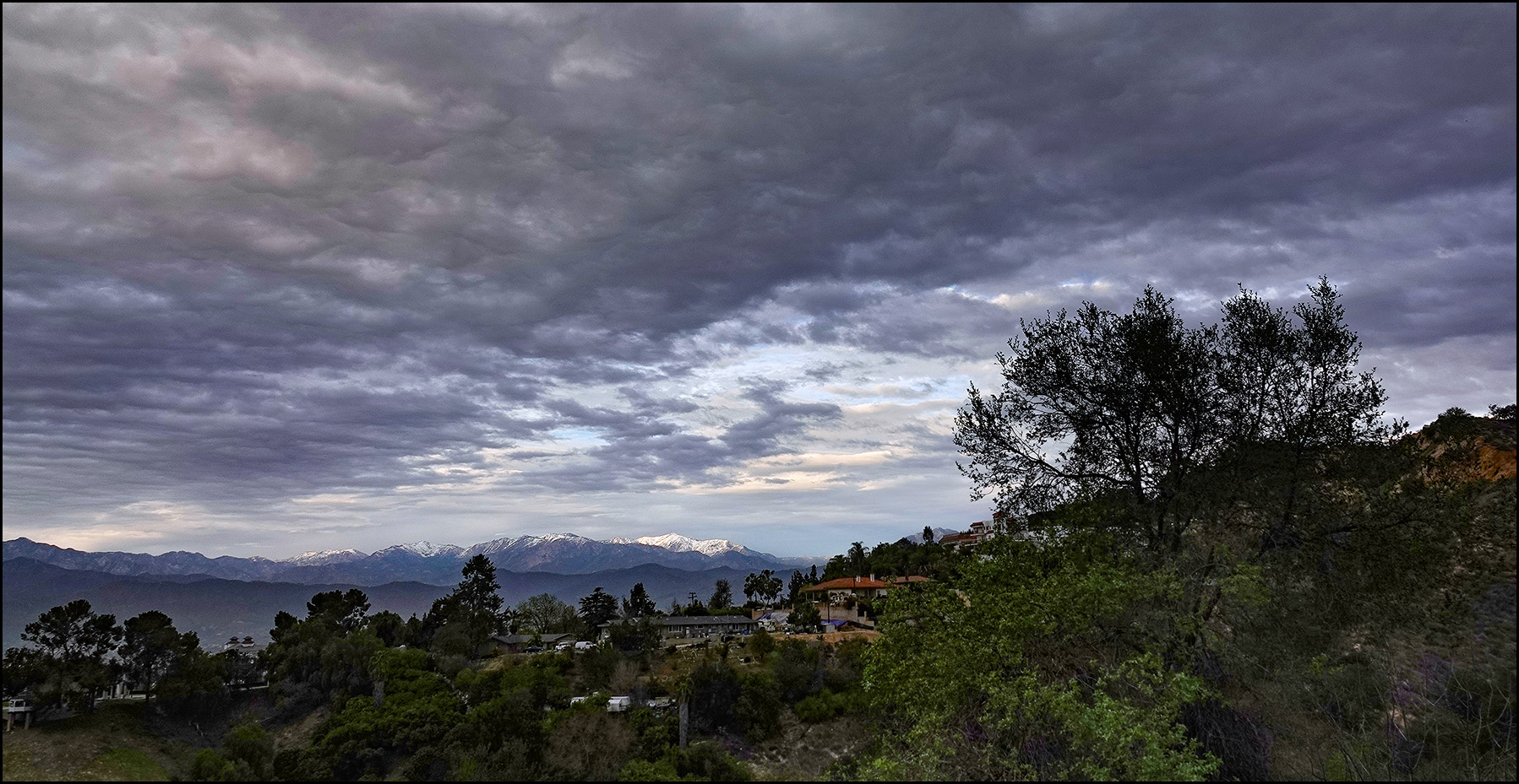
The geographic distance from Mount Baldy to Iron Mountain may be "short" in the terms we think of geography, perhaps five miles. But for climbers traversing a difficult and dangerous route along an exposed ridgeline, that distance may be "long" in climbers terminology.
That “no water sources” is a tell.
You always bring your own water to peak bag, so I don’t trust this description at all. I’m a rock climber: it has no entry on Mountain Project, so any technical routes are either a secret or garbage.
It may be a hard slog: 6000 feat of elevation gain is large. But color me skeptical about the hyperbole.
Huh, this guy says 7200 ft of gain and 13.5 miles. That is a very long, steep trail. I’ve easily done 13-14 miles in a day, but 7000 ft up is hella steep.
https://modernhiker.com/hike/iron-mountain-1/
Looks fun.
OK, that’s about 530 vertical feet per mile. The easy trail up Mt Monadnock in New Hampshire is 1800 vertical feet in two miles: 900’ vertical per mile. But then, it’s only 1.5 - 2 hours to the top, not an endurance test. There are very few bits where you need to use hands, as I remember. What I remember most is the kids that were frolicking past us older hikers. And the view from the top!
Well here’s a route (one of several) on AllTrails (Yelp for hiking) which says this trail is closed but has reviews and pics as recent as “last week”
Iron Mountain via Heaton Flats Trail [CLOSED]
https://www.alltrails.com/trail/us/california/iron-mountain-via-heaton-flats-trail?p=51261033&u=m
by the way, for those who care, youtube is awash in videos of every popular trail in the San Gabes. This is just one from that trail:
https://youtu.be/2lzF68sAtno
"Decomposed rock"? Pebbles, pointy pebbles.
Lol, us climbers call that “choss.” All rock is “decomposing” as it were.
Depending on the scale, most everything is.
I think "skree" might also be an appropriate noun, at least for what's nearer the base of the mountain. It's sharp and requires thick soles to comfortably walk over.
And,if it is loose, it slides down every time you step up so you feel like you're waking up a down escalator.
Is this a serious question? C'mon. A mountain 10 miles away from another mountain is "nearby". A 10 mile hike that also gains over a mile of altitude is a *long* trail! Especially if it's over the kinda terrain people have been describing here. I see nothing even close to a contradiction here.
> In the same sentence Mt. Baldy is "nearby" but the route from Baldy to Iron Mountain is "long." Which is it?
Mountains are big and "nearby" is in terms of units of mountains. People are small compared to mountains) and "long" is in terms of units of people-steps.